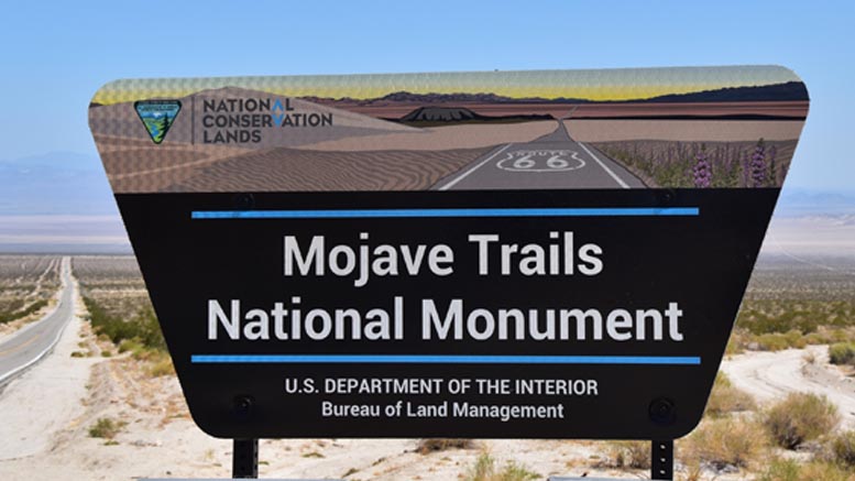
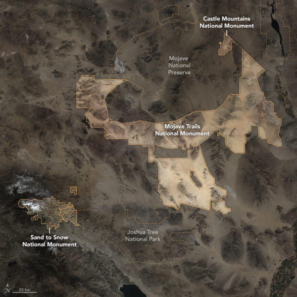
What, you’ve never heard of Mojave Trails National Monument? Despite being 1.6 million acres in size, I don’t think a lot of people have yet.
In February 2016, President Barack Obama created three new national monuments in California, Sand to Snow National Monument, Castle Mountains National Monument, and the massive Mojave Trails National Monument.
The monument, which encompasses a lot of the desert area between Barstow and Needles, contains the longest remaining undeveloped stretch of Route 66 and some of the best-preserved sites from the World War II-era Desert Training Center. The monument also connects Mojave National Preserve with Joshua Tree National Park, creating one of the largest protected desert areas in the world.
The entire area is a desert and history lover’s paradise. There are nearly unlimited things to do and see in the Mojave Trails National Monument, and narrowing down a list was difficult, but here are our top seven things to do in the national monument.
Visit Amboy and Hike Amboy Crater
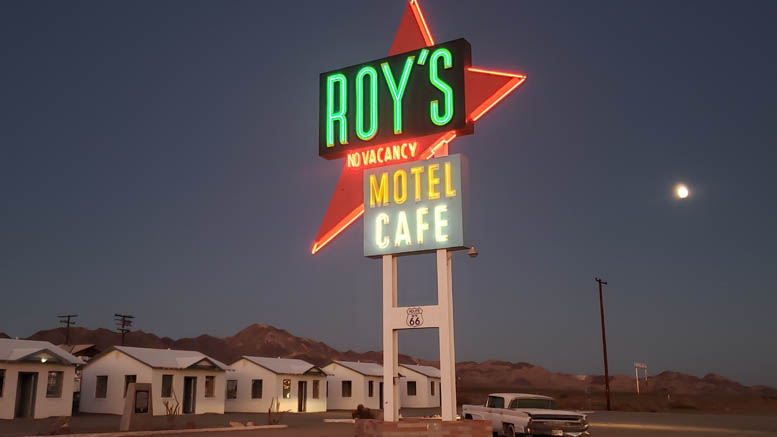
Amboy, CA, is home to Roy’s, one of the most iconic spots on Route 66. It is a fantastic spot to stop, take a few photos, and explore a little. Easily visible from the town and located just a few miles away is Amboy Crater.
Amboy Crater is an extinct cinder cone volcano that is 250 feet high and 1,500 feet in diameter. The crater was designated a National Natural Landmark in 1973, and the parking area features ample parking, picnic tables, and restrooms.
The trailhead to climb the crater is also located at the parking area. The trail is a 4.1 miles long, out-and-back trail. The trail is relatively flat until you reach the cinder cone, and then it gets pretty steep and rocky as you enter the cone through a breach on the backside.
The trail is straightforward to follow, and there are several rest areas along the way. I’d rate the hike as moderate difficulty, mainly due to the climb at the end and the uneven terrain coming back down.
The climb is over lava rocks as well, so it is best not to do the hike in any open-toed shoes. Also, summers get extremely hot, so it is best to do this hike in fall through spring.
Amboy Crater is amazing, and you really get the feeling of being on another world there (NASA even tested Mars rovers at the crater). The views from the top are excellent as well, and this is an overall enjoyable hike. I mean, how often do you get to climb into a volcano?
Explore Camp Iron Mountain
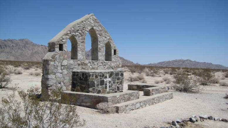
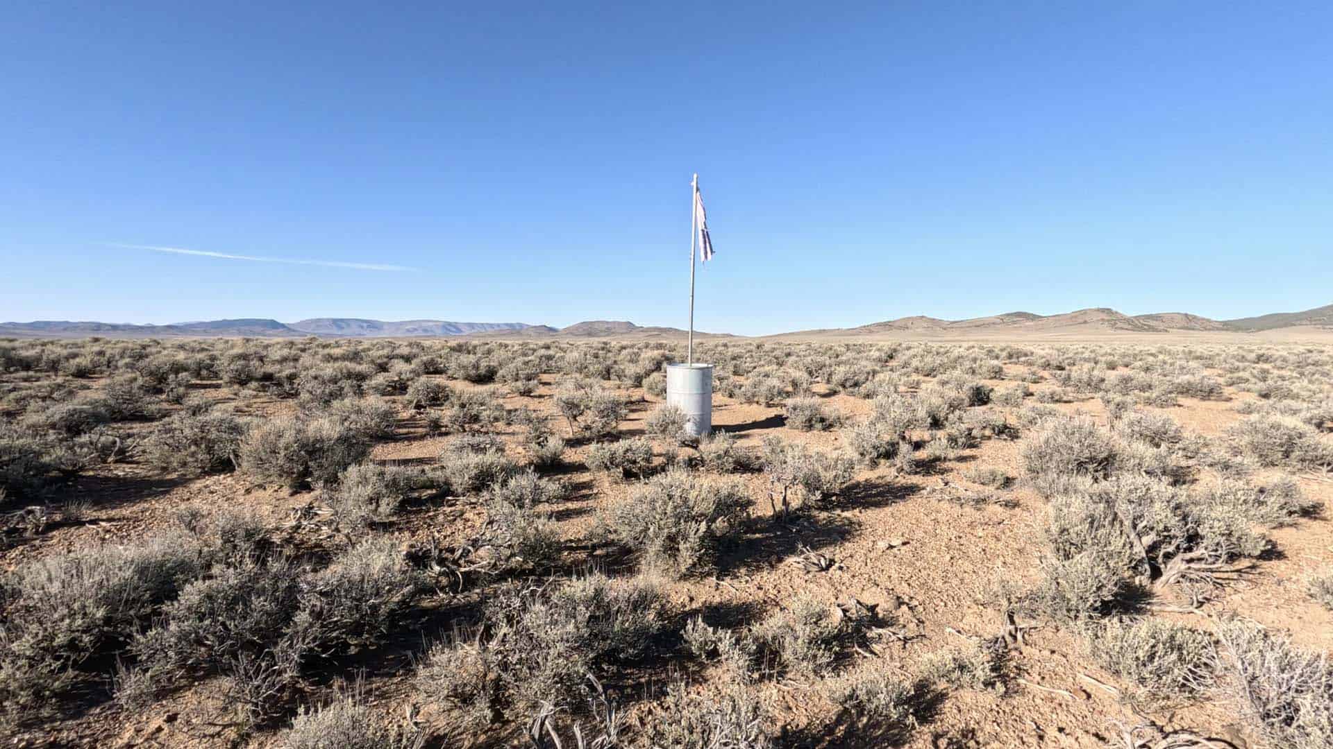
Located on the southern end of the monument near Highways 62 and 177, Camp Iron Mountain was the largest camp in General Patton’s Desert Training Center during World War II. Of all the former Desert Training Center camps, Iron Mountain is probably the best-preserved today.
Camp Iron Mountain was built in April 1942 to get soldiers ready to fight in North Africa. The 2nd Armored Division under General George S. Patton (Patton’s DTC headquarters was at Camp Young, where there is a cool Patton Museum) and the 80th Division were stationed there.
Today, the camp is probably best known for having two outdoor stone chapel altars that still stand. One of the altars was built for Catholic church services and one for Protestant church service.
Live fire exercises were held at Camp Iron Mountain too, and there are still warning signs all over the site.
The site also has a 200 feet by 175 feet relief map that represents the entire Desert Training Center/California-Arizona Maneuver Area to scale. The map once had wooden signs that represented prominent topographic features, including Divisional Camps. Highways, railroads, and the Metropolitan Water District. The map area is fenced off to protect it.
This is a must-see in Mojave Trails National Monument if you are a military or WWII history buff like me.
Stay in Afton Canyon
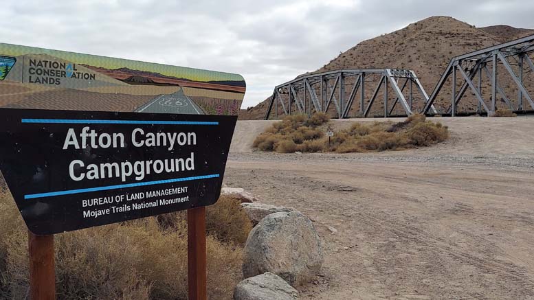
Afton Canyon is known as “The Grand Canyon of the Mojave” and is the only place where the Mojave River flows above ground year-round. It also features the only developed campground in Mojave Trails National Monument.
The campground is located about 4 miles down a well-maintained dirt road off I-15, and sites are available on a first-come, first-served basis. It currently costs $6 per night to stay there, with a 14-day maximum stay. A permit is needed for a campfire, however.
The scenery at Afton Canyon is spectacular, and there is plenty to do. Several hiking trails are easily accessible from the campground, and it is a great staging point for a number of off-road vehicle trails.
See the Cadiz Dunes
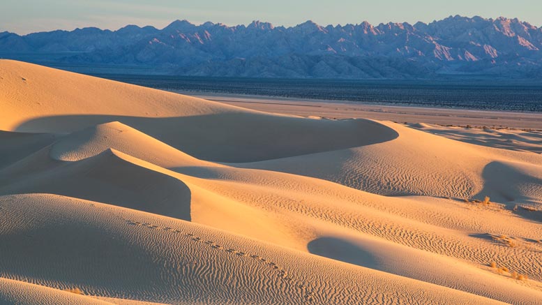
If you want to see an amazing site and get away from people, the Cadiz Dunes are for you. The dunes are located in the Cadiz Dunes Wilderness Area of the monument, so motorized vehicles aren’t allowed, meaning you will need to go on foot to see them. Even getting to the parking area to begin your hike requires a four-wheel drive.
The turnoff to the wilderness area is located off Cadiz Road. The road to the parking lot is extremely sandy, and you do not want to slow down or stop on the road until you reach a harder-packed area. The last 2.4 miles of the road is extremely rough and is accessible only with a high clearance four-wheel-drive vehicle.
The challenge of getting there makes the rewards that much sweeter, though, as you are unlikely to see another sole and have this pristine wilderness all to yourself.
The dunes were formed by north winds blowing sands off the Cadiz Dry Lake, and because of their remoteness, the dunes are pristine. In the spring, you can see a display of unique dune plants, including the endangered Borrego milkvetch.
This area gets extremely hot and is best avoided in the summer when the temperatures are often well over 110 degrees.
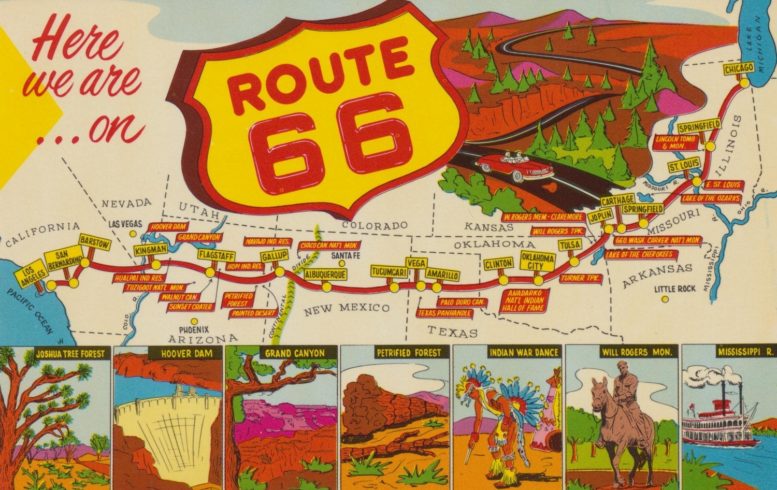
Get Your Kicks on Route 66
If you’ve been following this site or our YouTube channel, you probably know what a fan of historic Route 66 I am. Mojave Trails National Monument includes 105 miles of U.S. Route 66, including the longest remaining undeveloped stretch of the highway.
There is quite a bit to see: the aforementioned Amboy, the mysterious Route 66 lions, the Roadrunner Retreat, and so on.
Unfortunately, as of October 2021, most of Route 66 through Mojave Trails National Monument is closed, and there is no timetable for its reopening. A number of bridges on the road washed out a few years ago, and the County of San Bernardino has their repairs as a low priority for its limited funds. I will update this article when the road reopens.
See the Stars Near Snaggletooth Peak
Snaggletooth Peak is located right off Highway 95, south of Needles. Looking at the mountain and its jagged summit, it is easy to see how it got its name. You can hike to the top, but the last little bit requires some actual rock climbing skills. The real appeal to the area, though, is the dark skies.
There are plenty of dispersed camping options below Snaggletooth, including the Snaggletooth Primitive RV Camp. Even though it is easy to access, being only about 17 miles from Needles, there probably won’t be many people around at all. At night the skies are stunning. Seeing the Milky Way is a real treat in Southern California.
Look for Wildlife at Bonanza Springs
Bonanza Springs is the largest freshwater spring system in the Mojave Desert, making it an amazing place to look for wildlife. Located about 50 miles west of Needles, the springs are tucked into a small canyon of yellow and white limestone that makes a beautiful backdrop.
The Bonanza Spring wetlands are the largest within a 1,000 square mile area, and the shallow water supports catfish and bluegills. Surrounding the springs, you can find mesquite, cottonwood trees, and cattails. Most remarkable is probably the frogs. Despite being so far from any other water source, Bonanza Springs is inhabited by a number of frogs and toads.
Humans have also used the springs since prehistoric times, and more recently, the Santa Fe Railroad had a stop called Danby (which is now a ghost town), where they refilled its water tanks for their steam engines from a pipeline from the springs.
Because of the number of animals that depend on the springs, the BLM asks that visitors minimize their stays near the water. Luckily, viewing areas, which have picnic tables and fire pits, are nearby to allow for wildlife watching.
Before You Go
Mojave Trails National Monument is an amazing place to visit and explore, but it can also be dangerous if not prepared. Take extreme caution if visiting in the summer as it can get very hot. Temperatures can hit over 120 there. The fall through spring is the best time to visit as the weather will be much cooler. In the winter, it can get extremely cold at night, though, so plan accordingly.
Also, you can not rely on cell service. In some parts of the monument, especially near Needles, you can actually get pretty good service, but in most of the park, you’ll get nothing. There aren’t a lot of services in the area, too, so make sure to fill up on gas, food, and water when you have the chance and before you head out.
For those who collect National Park Passport Stamps like us, keep in mind that Mojave Trails National Monument is administered by the BLM and not the NPS, so there is no passport stamp. There is also no official visitor center yet.
This list is just the tip of the iceberg of things to see and do in Mojave Trails National Monument. Every time we visit the area, we see something new and have a different adventure.