If you are driving on the Sunrise Highway (California S-1) in eastern San Diego County or even hiking the Pacific Crest Trail just north of Mt. Laguna and are looking for a fun stand-alone hike in the area, Garnet Peak is certainly worth taking the time to summit. It is easily my favorite hike in the Laguna Recreation Area.
Garnet Peak, at about 6,000 elevation, is on the on the edge of the Laguna Escarpment and features stunning views of the Anza-Borrego Desert below. If you do this as a stand-alone hike the distance depends on where you park, but it can be as short as 2.2 miles round trip. For those hiking the Pacific Crest Trail, doing this side trip it will only add about a mile to your trip, out and back.
| Distance | Elevation Gain | Route Type |
| 2.2-5.6 miles | 668 feet | Out and Back |

How to Get There
If you are coming from San Diego, take Interstate 8 east toward El Centro and exit at S-1 (Sunrise Highway). Head north on Sunrise Highway 14.2 miles to a pullout on the right side of the road at mile marker 27.8. There are signs to mark the starting point for the Garnet Peak Trail.
Alternatively, for a little bit longer hike you can park at the Penny Pines Trailhead at mile marker 27.3. There you will head on the PCT going north.
A third and even longer option is to park at the Pioneer Mail Picnic Area at mile 29.3.
You may also climb the mountain from the desert below, but I have never tried that approach.
If you are hiking on the PCT heading north, the turnoff to Garnet Peak is about 0.8 miles past Penny Pines and if you are heading southbound it is about 2.3 miles past Pioneer Mail.
Fees
Depending on where you park, you may need to have a National Forest Adventure Pass or a America the Beautiful Pass (National Parks). The Penny Pines Trail Head parking is listed a fee-free area.
The Hike
This is a fairly easy hike, though it is extremely rocky. If you plan on doing it as a stand-alone hike and want to bring kids, my 7-year-old had no trouble with the hike at all.
If you are doing this as a stand-alone hike, starting from the mile marker 27.8 on Sunrise Highway, follow the trail northeast for 0.6 miles to a junction with the PCT. This first 0.6-mile portion of the trail passes through habitat that was burned in the 2003 Cedar Fire and the 2012 Chariot Fire. You can still see some signs of the fires after all these years.
Once you hit the PCT, you keep going straight and cross it. You will see a wooden sign for Garnet Peak. You will begin a moderate incline along the western shoulder of Garnet Peak. The trail will start to get pretty rocky at this point, but it is more of an issue when coming downhill.

The trail will start to curve to the east as it wraps around the summit. Towards the very end, the last 20 feet or so is when the trail gets at its steepest and you may need to use your hands to get to the summit.
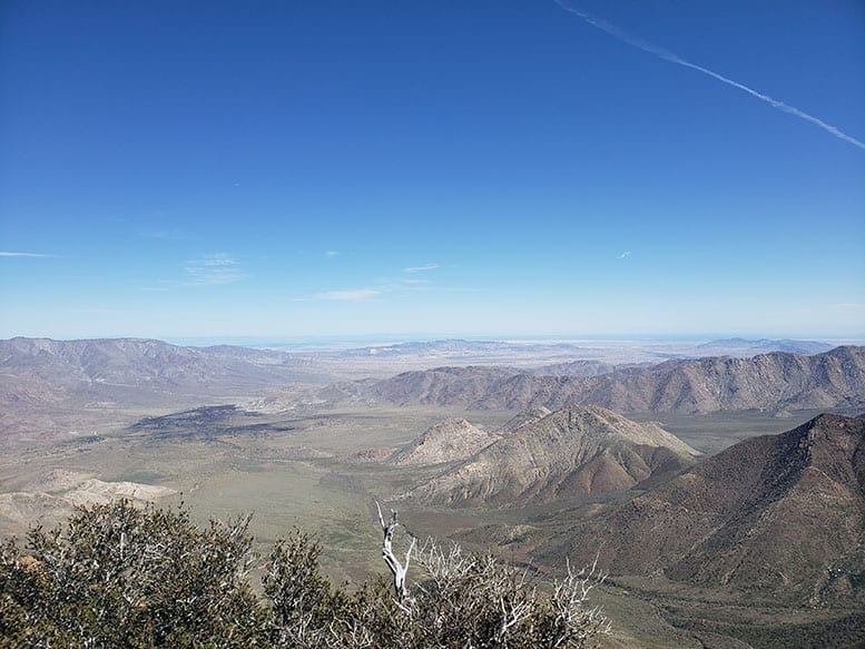
At the summit, you are high above the Anza Borrego Desert below. On a clear day, you can see all the way to the Salton Sea. To the south, there is Monument Peak and the Laguna Observatory and Mexico further still. And if you look west you can see Cuyamaca Peak, Middle Peak, North Peak, and occasionally a sliver of the Pacific Ocean.
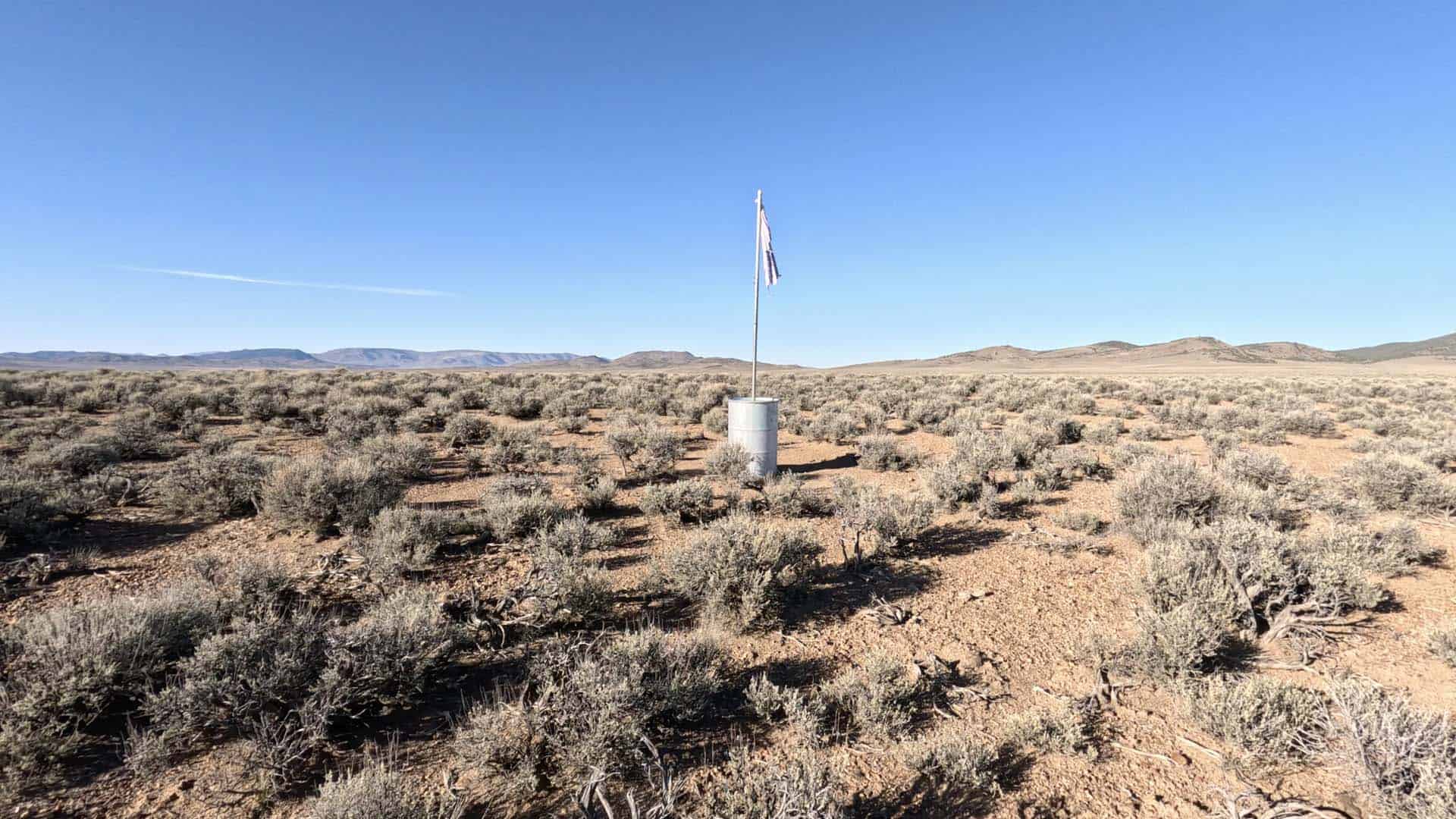
There is a box with a summit log at the top of Garnet Peak, however, on my last visit, the summit marker was missing (see the photo below).

Garnet Peak is probably the best place in San Diego County to watch the sunrise as well. It is also accessible year-round. The Laguna Mountains can get snow in the winter, but it is usually fairly light and you will not likely need crampons or any other special gear to make the climb in winter.
Garnet Peak is a fun, short trail with amazing views and worth taking a little time off the PCT or venturing out to the Lagunas to do it as a stand-alone hike.