Recently, we were visiting Tonopah, Nevada, and I realized that we were close, well, as far as the wide open spaces go, to the geographic center of the state. So, we headed out into one of the most remote parts of the state in order to reach its center.
Heading north from Tonopah, we decided to take the road less traveled and drive through Monitor Valley, a place with no towns, gas stations, or paved roads.
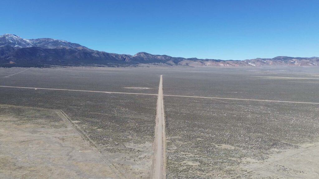
If you’re looking for a place that truly captures the scale, isolation, and quiet beauty of Nevada, Monitor Valley is hard to beat. Tucked between the Toquima and Monitor mountain ranges, this broad basin stretches nearly 90 miles north to south and spans roughly 10 to 20 miles across, making it the fifth-longest valley in the state.
Monitor Valley feels like one of Nevada’s best-kept secrets. Aside from a few scattered ranches and weathered ruins, the only signs of modern life are pale ribbons of dirt road cutting through a vast, open landscape that feels largely unchanged for more than a century.
Why It’s Called Monitor Valley
The name “Monitor” has a surprisingly nautical origin. Early settlers thought the flat-topped profile of the nearby mountains resembled the deck of the Civil War ironclad USS Monitor, and the name stuck. It’s an odd comparison in the middle of the Great Basin, but once you know it, it’s hard not to picture it.
Long before ranchers and miners arrived in the mid-1800s, this valley was home to Western Shoshone camps. Today, Monitor Valley remains sparsely populated, quiet, and remote, exactly the kind of place where Nevada’s sense of space really sinks in.
The Road
The route through the valley is commonly referred to as Belmont Road, also known as Monitor Valley Road. The drive typically begins near the ghost town of Belmont and runs straight through the heart of the valley.
To put the remoteness into perspective: it’s about 70 miles from the ghost town of Belmont, where the pavement ends, to the next nearest paved highway. That highway is U.S. 50, often called The Loneliest Road in America. When even the Loneliest Road in America is far away, you know you are in a remote area.
Despite being unpaved, the road is often in surprisingly good condition. That’s because for about 40 years, it was officially Nevada State Route 82. In the early 1970s, the Nevada Department of Highways began removing low-traffic rural routes from the state system. SR 82 disappeared from official maps by 1980, and maintenance responsibilities shifted to Nye and Eureka counties.
While its designation as State Route 82 is relatively recent history, the road itself is much older. Belmont Road follows an alignment that dates back to the 1800s, when it functioned as a wagon road linking ranches, mining camps, and supply towns.
Ore wagons, freight wagons, and riders on horseback would have passed through this valley regularly, especially during boom periods in nearby mining districts. Over time, repeated use etched a permanent path into the landscape, a route that persists today largely unchanged.
Driving it now feels like moving through layers of time. The road may be smoother, but the views, distances, and sense of exposure are likely very similar to what travelers experienced more than a century ago.
Diana’s Punch Bowl

One of Monitor Valley’s most unexpected sights is Diana’s Punch Bowl. Rising from the desert floor, this natural feature looks almost unreal: a rounded travertine limestone dome with a steaming pool at its center.
The punch bowl is roughly 50 feet across and about 30 feet deep, with water temperatures estimated between 140 and 200 degrees Fahrenheit. It formed over thousands of years as hot groundwater rose through fractures in the Earth’s crust, depositing mineral layers until it built up into a sealed, cauldron-like mound.
A small stream flows from beneath the dome, where the scalding water cools enough for wildlife to drink, a rare and vital water source in an otherwise dry landscape.
No one knows exactly how Diana’s Punch Bowl got its name. The most common explanation ties it to Diana, the Roman goddess of the hunt. Geological survey notes from the 1940s mention that it was “locally known as Diana’s Punch Bowl,” suggesting the name had already been in use for some time. Before that, it was likely known only to ranchers and hunters who happened upon the steaming mound in the middle of the valley.
Potts Ranch and Early Ranching History
Most of Monitor Valley lies on land managed by the Bureau of Land Management. That’s typical for Nevada, where about two-thirds of the state is BLM land and roughly 85% is publicly owned.
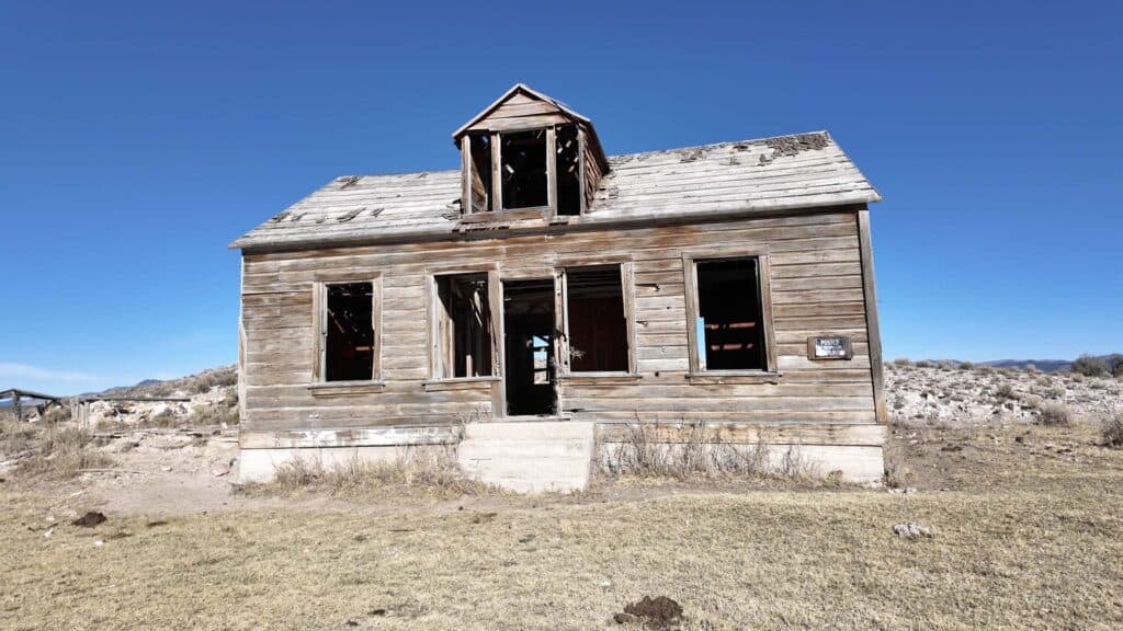
One of the valley’s most important historic sites is Potts Ranch, established in the 1870s by William Potts, a Scotsman who recognized the valley’s potential for livestock. From modest beginnings, Potts Ranch grew into one of Nevada’s better-known cattle operations.
Supplies came from Belmont, nearly 40 miles away. In 1898, the ranch even gained its own post office, a sign of how isolated yet self-sufficient it had become. Several members of the Potts family served as postmaster or postmistress over the years. The post office remained in operation until 1941, and by 1944, the ranch had been sold, marking the end of an era.
Finding the Geographic Center of Nevada
The main goal of our trip was to visit the geographic center of Nevada, although there is more than one location that claims that title.
Our first stop was the original geographic center as determined in the 1920s.
During that time, the U.S. Geological Survey calculated geographic centers using a simple physical method. Each state’s outline was cut from cardboard, suspended from a string, and the balance point was marked. That point was designated as the center.
Using this method, Nevada’s center was placed near:
39.319917, -116.637028
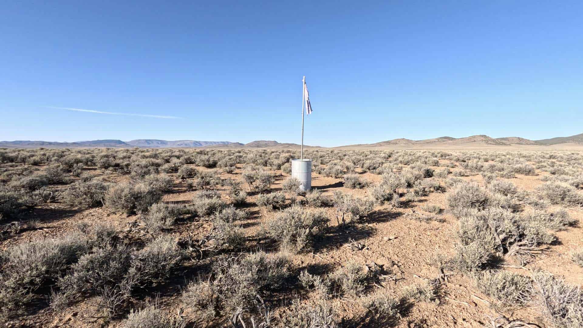
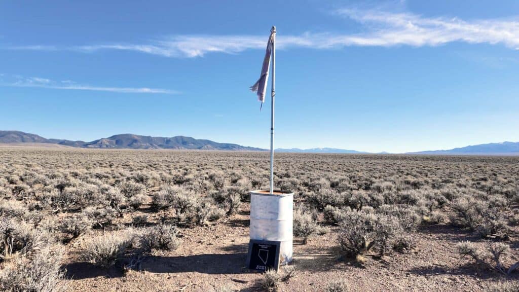
After turning off Belmont Road and traveling about a mile and a half down a smaller dirt road, we parked and continued on foot.
In the distance, we spotted a flag roughly where the original center point should have been. As we approached, we found a torn and weathered Nevada state flag mounted in an oil drum, along with a small plaque marking the spot.
From this location, there were no signs of civilization in any direction aside from our vehicle in the distance. Just open valley floor, surrounding mountains, and brush stretching to the horizon.
The Updated Geographic Center of Nevada
Next, we headed toward the updated center point, which turned out to be fairly close.
In 2015, the U.S. Geological Survey recalculated state geographic centers using modern GIS technology. Nevada’s center shifted slightly to:
39.328900, -116.631200
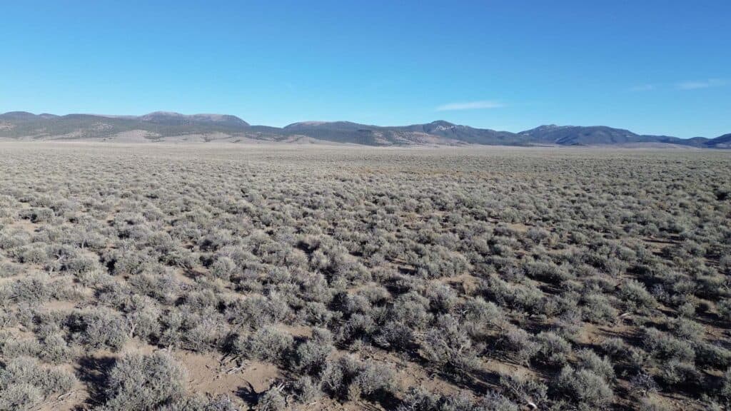
After returning to Belmont Road and driving less than a mile, we set out on foot again to locate the new point. This time, there were no markers to guide us.
When we reached the location, there was nothing there to indicate it was the center of the state. Just a few footprints left by other travelers who had likely made the same journey. The scenery was nearly identical to the earlier site, which made sense given how close the two locations are.
The two points are separated by a very short distance, especially considering the size of Nevada. Standing in the middle of Monitor Valley, surrounded by open land in every direction, it’s easy to forgive the imprecision of the early cardboard-and-string method.
Perhaps it’s fitting that the geographic center of Nevada isn’t defined by a large monument. Instead, it’s marked by silence, distance, and open sky, a perfect reflection of the state itself.
Note: Recently, the Nevada Association of Land Surveyors visited Monitor Valley and pinpointed a new exact center of Nevada, marking it with a monument. We didn’t see it on this trip, but it’s located near the other two points. So, in a way, Nevada now has three geographic centers.
If you’re interested in these kinds of places, we’ve visited other state geographic centers too. You can find them all here.