Unlike other states, getting to the geographic center of Arizona isn’t very easy. There are no roads that lead there or any nearby hiking trails. The easiest way to get there involves a canoe and some bushwhacking. Luckily there are a few less adventurous ways to see a central location in Arizona.
The Geographic Center of Arizona Monument
About 23 miles southeast of the historic town of Camp Verde, surrounded by nothing but wilderness, is where you’ll find the designated geographic center of Arizona. But the monument for the geographic center is actually pretty easy to access if not a little challenging to find.
We drove an hour and a half north from Phoenix up Interstate 17 to get to Camp Verde. Once we arrived we were pleasantly surprised at how awesome Camp Verde was.
The town of Camp Verde has a history that dates back to the 1860s. In 1865, Camp Lincoln was established, and shortly after that, the camp’s name was changed to Camp Verde. The camp moved to its present site (which is where the Fort Verde State Park is now located) in 1871, and the town of Camp Verde began to spring up around the military base. The military left in 1891, but the town remained.
Throughout the town, you can find many historic buildings from the late 1800s and the early 1900s. Quite a few buildings in the town are listed in the National Register of Historic Places. Visiting Camp Verde is like taking a trip back in time to see the American West of the early 20th century.
Camp Verde is also conveniently the central most town in the state of Arizona, so it is the place where it was decided the Center of Arizona Monument should go.
While most of the town’s attractions, including the Fort Verde State Park, are located in the center of town, the monument for the Center of Arizona is not. To find the monument, you need to head north from the old town on Montezuma Castle Highway (which will also eventually get you to Montezuma Castle National Monument, which is well worth visiting if you are in the area).
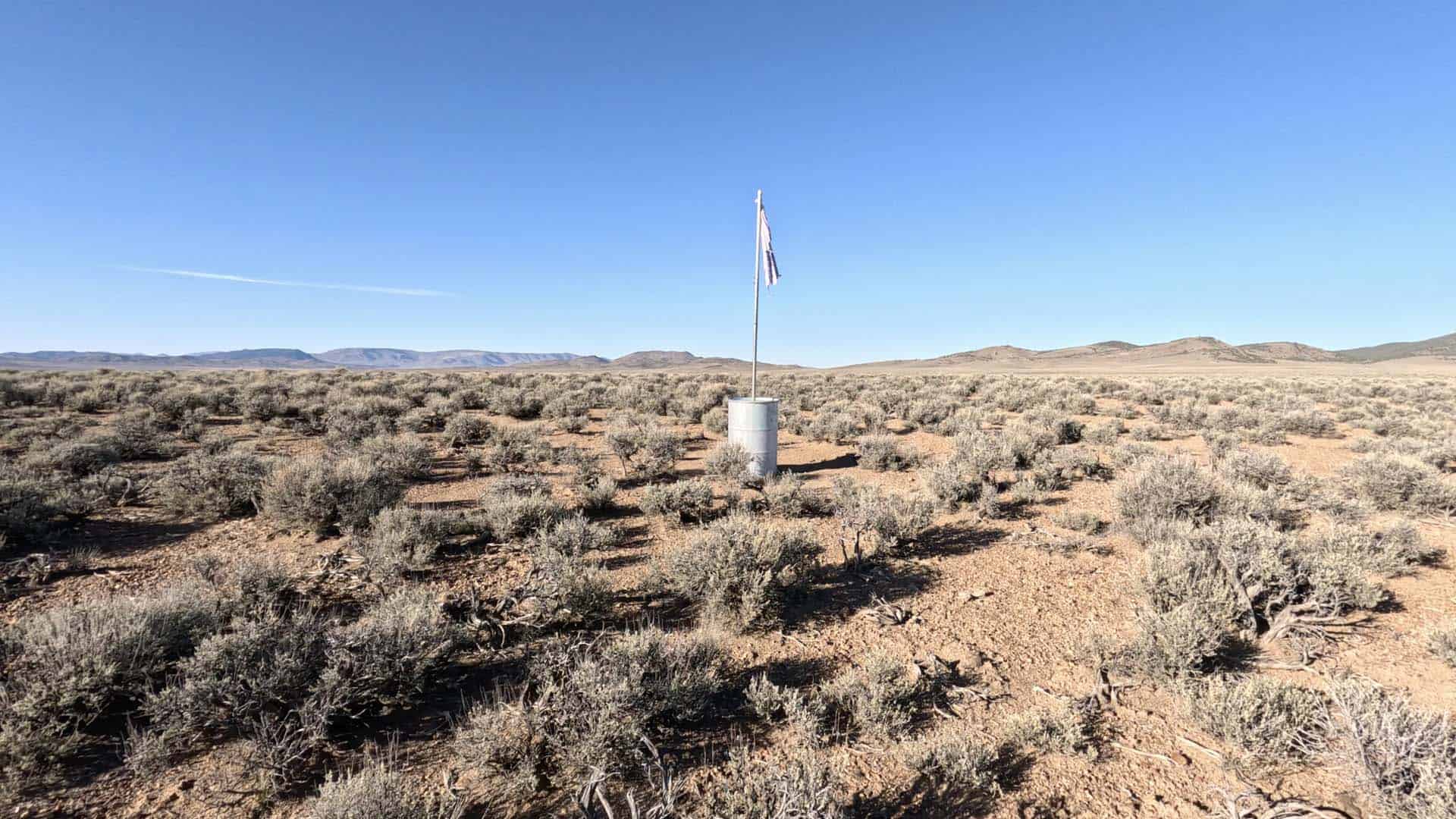
Right before crossing the Verde River, there is a small park on the left side of the road across the street from the library. This is Rezzonico Family Park. It is here where you will find the monument for the Center of Arizona.
Once you get into the park, head to the northwest most corner, and you’ll find the monument in a shaded area. There is a large plaque of Arizona, showing the center with coordinates and an informational sign showing how they determined where the center of Arizona is. That’s pretty much it.
While there isn’t much to see at the Geographic Center Monument, Camp Verde itself is a great destination and well worth spending a day exploring.
Arizona Baseline Monument
The Geographic Center of Arizona isn’t the only center place in Arizona worth checking out. The Arizona Baseline Monument (Gila and Salt River meridian) in Avondale is fun to visit and afford some pretty great views.
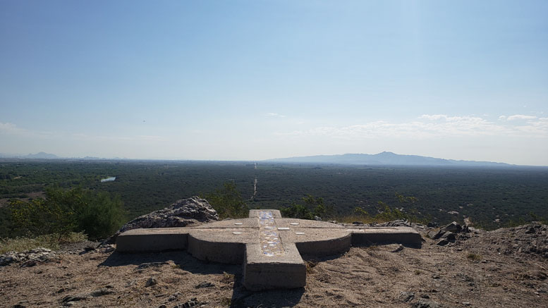
Located on top of Monument Hill, which is at the north end of the Sierra Estrella Mountains near the confluence of the Salt and Gila Rivers, and just east of the Phoenix Raceway, the baseline monument is the point where all land in Arizona is measured from.
Interestingly, Monument Hill is not named for the baseline marker but was named that because when Lieutenant Amiel Weeks Whipple surveyed the hill in 1851, there was a small monument built on the side by Mexicans in the area.
Since it was decided in 1865 that this would be Arizona’s initial point, Monument Hill has been the point of reference that most land in Arizona is surveyed from. From the monument, east and west extend the “Gila and Salt River Baseline” (also the alignment of Baseline Road) and the north-south “Gila and Salt River Meridian” (115th Avenue). From this point, all the land in Arizona is divided into 6-mile square townships, which are subdivided into 36 one-square-mile sections. Each township is identified by its position relative to the initial point on Monument Hill.
The original baseline monument for Arizona’s initial point has long been destroyed, but the current one was placed there in 1984.
The views from the top of Monument Hill are amazing, and it’s pretty easy to tell why they picked this place. There are a number of survey markers at the top, as well as a plaque stating that this point is on the National Register of Historic Places.

The top of the hill is on the grounds of the Phoenix Raceway, so it is not accessible without a ticket during race events. So keep that in mind if you decide to go.
There are hiking trails to get to the top, and from the parking lot, it is about a quarter of a mile hike to the top, with a few hundred feet of elevation gain. The trail is pretty straightforward; just keep heading up.
If you’re interested in these kinds of places, we’ve visited other state geographic centers too. You can find them all here.